ONLINE FORMAT
| Image | 7 |
| Folder | 1 |
LOCATION
| North Carolina | |
| South Carolina | 2 |
| Maryland | 1 |
| Virginia | 1 |
SUBJECT
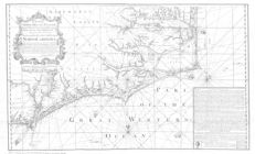
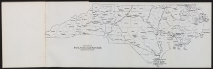
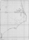
North Carolina Maps
Maps documenting North Carolina’s counties, cities and towns, roads, historic events and natural features are gathered here. The maps range in date from the 15th Century to the 20th.
![A new and correct map of the province of North Carolina drawn from the original of Colo. Mosely's [i.e. Moseley's]](https://digital.lib.ecu.edu/encore\ncgre000\00000005\00004542\00004542.jpg)